An atlas of human stories — and the people mapping them.
Empathy Atlas turns datasets and maps into empathy. This is what it is, the funded work at its heart, how each experience fits, and the explorer behind it.
The concept
Every point is a person. Every layer, a lived reality.
Empathy Atlas isn’t a single map — it’s the whole: a growing family of mapping experiences, each of which is (or contains) an atlas of its own, all feeding one shared understanding. Where a conventional map shows you what and where, the Empathy Atlas holds the who and the why— the story behind each number, told by the person who lived it.
The emotion system
hopebelongingfreedomgriefpridewonderloss
Words on a map, colored by the emotion they carry and sized by how often they were shared. In XR and VR they surround you — whispers at a distance, clear as you approach.
Data as listening
We hold the human context behind the data, so understanding can become empathy.
Layered realities
Stories sit against the geographies and datasets they belong to: freedoms, work, movement, time.
Immersive by design
Explore in map, XR, and VR. Choosing a feeling lets the stories connected to it flow out.
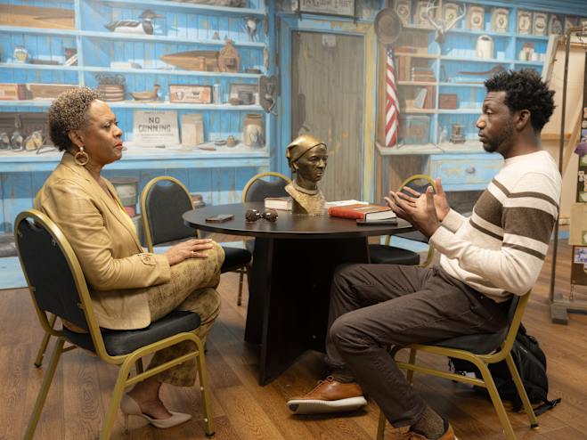
National Geographic Explorer Clinton Johnson talks with Linda Harris, Director of Events and Programming at the Harriet Tubman Museum. Photograph by Kris Graves
The funded project
Reflecting in place, along the road to freedom.
At the heart of the atlas is a funded body of work bringing Black migration histories to life, beginning with the Underground Railroad. People are interviewed in placeat historic sites, reflecting on the ground where freedom was sought. Their voices, and the emotions inside them, become the atlas’s first layer.
Supported by the National Geographic Society.
The experiences
Two ways the work reaches people
Where Freedom Walked and Liberation Lines are the two outputs of the funded project, different doors into the same atlas. Each one gives back to the shared concept and the models the project produces.
Output of the funded project
Where Freedom Walked
Reflections recorded in place at historic Underground Railroad sites. The interviews and emotions gathered here are the first stories in the atlas, and the raw material for everything it builds next.
People map their family across three generations, where they lived, the work they did, the decades they were born, and watch their line join a whole community lit across the map. It carries the concept to living families, using the same emotion system and data models the funded work produced.
National Geographic Explorer · antiracist geostoryteller
Clinton is the creator of Empathy Atlas and the founder of NorthStar of GIS, a nonprofit advancing racial justice and Black representation across geography and GIS. He believes a map can be a form of listening, and has spent his career making geography a tool for equity rather than exclusion.
Today he is CEO & Chief Visionary Officer of Us At Spaces. He began in Philadelphia as the city’s first Chief Enterprise Architect and served as the NAACP’s first Senior Vice President of GeoEquity Innovation. Empathy Atlas is where his data work and his storytelling meet.
National Geographic Explorer— 2023 Wayfinder Award